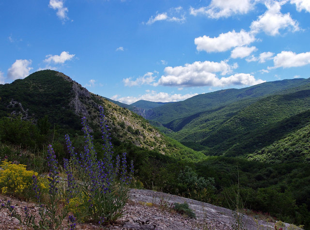
Once in the Big Canyon of Crimea with an ordinary excursion, it’s hard to understand where such a loud name comes from. Ordinary, after all, a gorge.
Bathtubs, small waterfalls… Cute, of course, but not so much to claim such a sonorous name.
In fact, they’ve only glimpsed it! For the place that can claim the name «canyon», and even «big», is further away, a few hundred meters from the «Bath of Youth». The way there is not easy. The riverbed behind the «bathtub» is difficult to pass. A group of trained tourists pass the 2-kilometer section from the «Bathtub of Youth» to the exit from the canyon for 3 hours! This in itself speaks of the complexity of the route.
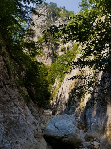
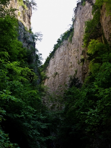
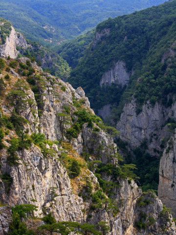
But all the difficulties are more than compensated by the strongest impressions that everyone who steps on the rocky bottom of the Grand Canyon gets. Practically sheer, 300-meter high rock walls converge here, leaving a narrow 1.5-2 meter corridor. In the narrowest place of the gully you can spread your arms and touch both sides of the canyon at the same time. And huge rocks go high and high, leaving only a narrow strip of sky above your head. It is dusky, damp and quiet.
 .
.
Except that woodpeckers and crows occasionally break the silence. Occasionally, a small pebble will fall off a rock, and the sound of its fall will echo off the walls with a rattling, frightening echo.
There are four such narrow corridors in the canyon. The longest and, perhaps, the most picturesque is the first one. Its length is about 200 meters. The shortest is the fourth and the last one.
Between the corridors the channel widens to 5-6 meters, not more. Throughout its entire length it is blocked with stones and huge boulders, interspersed with rounded smooth-walled baths. In summer the bottom of the canyon almost completely dries up. Right behind the «Bath of Youth» it is still full of water, there are springs there. But already on the approach to the first corridor the bottom is exposed and further water can be found only in separate baths. In spring, when a fast water stream rushes through the gorge, it becomes not only difficult to pass through, but also dangerous. The same is true after heavy rains. Soaked rocks become slippery, it is impossible to stay on them, and the ground on the slopes becomes soaked. One would not envy anyone who finds himself here in such weather!
 .
.
Up to the very top the path is extreme. Even where the slopes become lower, there are difficult sections. Only at the very end, where the canyon gradually passes into the Kura-Uzen basin, there is something similar to the usual footpath.
Walking through the two-kilometer stone gap of the canyon, one can’t help wondering what forces created this miracle of nature.
The origin of the Grand Canyon is not erosional, but tectonic. The river did not wash out this hollow in the limestone, but simply «took the easy way out» along the already existing tectonic crack.
Each protrusion of the right side of the canyon corresponds to an excavation in the left side, and vice versa. Layers of same-age rocks lie on opposite sides at different elevations. This would not be the case if the channel had been mined by a river. The Grand Canyon was born out of a great catastrophe. Tectonic forces once lifted one block of the Earth’s crust almost a kilometer from the other along a fault.
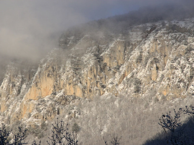
The edge of the raised block seemed to break under the weight of its own gravity, forming a giant crack. That’s where the modern Grand Canyon was formed. Therefore, to claim that it is laid along the fault, as it is done by some tour guides, is incorrect. The fault line runs slightly to the side of the riverbed.
The Grand Canyon is a peculiar ecosystem, different from the surrounding area. The high, close-knit rocks of its sides limit the access of sunlight, so all phenophases in the canyon bed come with a delay of 3-4 weeks. Remains of relict vegetation are preserved here. There are a lot of old age-old yews in the canyon. These are relict trees, once widespread throughout the mountain forests of the peninsula, now they are found only in some places where there is shade and moisture.
In the Grand Canyon there are more than 1200 specimens of berry yew, some of them reach a height of 10-12 meters. Another rare plant is a fern with uncut leaves, scolopendra leaflet or «deer tongue». There is also the Venus’s slipper orchid, the hyoid needlewort, and the endemic irrigated stonecrop.
 .
.
It is home to a large number of orchids, many of which are red-listed species. In the canyon there are 70% of all species of orchids living in the Crimea. In the cool river waters there are brook trout. In the old days there were many roe deer in the vicinity, but the current crowds were not to their liking.
For millions of years the river Auzun-Uzen (translated from Tatar — mouth. «auz» — «mouth, mouth», «uzen» — «river») has been flowing along the bottom of the crack for millions of years. The waters of another river, the Sary Uzen (yellow river), rush towards it from the slopes of the Sedam-Kaya massif. At the confluence of the Sary Uzen and Auzun Uzen. Here, having united their waters, they give rise to a new river — Kokkozka. So, heading to the canyon, we pass by three rivers: descending from the parking lot we go along the Sary-Uzen; stepping on a wooden bridge we cross the Kokkozka and then start moving along the bed of the Auzun-Uzen.
Above Auzun-Uzen takes several tributaries. The very first left tributary is called Almachuk. In translation from Tatar it means «apple». In one of the guidebooks the name is explained by the fact that upstream grows a lot of wild apple trees and fallen fruits are washed into the tributary channel by autumn rains, and it carries them to the canyon, where they accumulate in large quantities. The place opposite the mouth of Almachuk is called Yablorny ford.
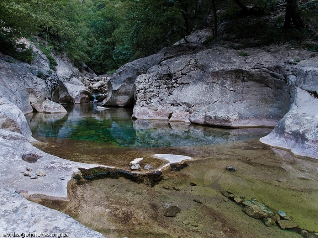
Just beyond Applewood ford, the waters of the Pania Spring flow into the canyon. «Pania» is a corruption of «Panagia» — «All Saints». In the medieval Crimea was very developed cult of holy springs, rapidly reviving and in our time. Perhaps the source of Pania was one of such places of worship. This is a very powerful spring, which is one of the 20 largest in the Crimea. Its average flow rate is 370 liters per second. This amount of water would be enough to supply water to a small town.
In summer, Paniya is slightly shallow, but during this period it pours its waters not a weak key, but almost a river flow, causing surprise to visitors to the canyon. The water in the spring is exceptionally cold, and you have to change your hand more than once before you fill a flask.
Not far from Paniya, behind the tributary Dzhevizkyl, the tributary Yohagan-su («missing water» in Crimean Tatar) flows from the right side, flowing into the canyon bed above the bath of youth. In summer it dries up. Its lower part is a succession of smooth-walled tubs, bridging one after another on a steep slope. It seems unbelievable, but there are extreme people who manage to climb these tubs and get out along the tributary channel to the right side of the canyon!
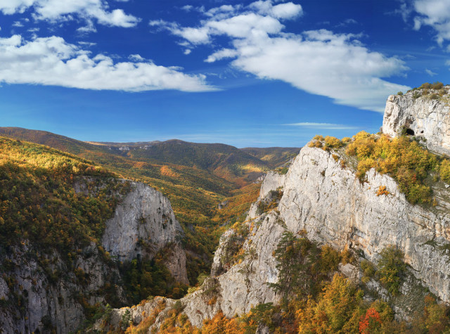
People have known about the existence of this giant crevasse for a long time. It was mentioned in scientific works, it was put on topographic maps. But it was not included in the section of Crimean sights. It did not even have a name in those years. The Crimean Mountain Club, which was organizing educational travels in the early twentieth century, did not include the Grand Canyon in its itineraries. Neither in guidebooks, nor in any local lore works it was not even mentioned. Professor Puzanov was the first to tell the world about this wonderful place in his books. He also gave it a name. The very name that every travel enthusiast knows today. Admiring the grandiosity of the place, Puzanov called it the Grand Canyon of Crimea, by analogy with the American Grand Canyon of Colorado. Although, frankly speaking, our Grand Canyon is as much smaller than its American counterpart as Crimea is smaller than the North American continent. Judge for yourself: the length of our Grand Canyon — 3 km, the Colorado Canyon 320 km, the depth of the Grand Canyon of the Crimea — 300 m, the Colorado Canyon — 1800 m, width respectively — 150 — 200 m., and — 8 — 12 km. But is it just the size of the matter?! Is our Crimea famous for its size?
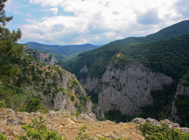
After passing the canyon, you should definitely see it from above. On both sides of the canyon there are paths leading to the capes dominating over the gorge. These are excellent vantage points. Especially picturesque scenery opens from the Watchtower Cape.
 .
.
The view from Cape Four is also wonderful, especially since it will be the first vantage point after climbing the plateau. In the past, as the books say, one of the best panoramas was from Cape Trapis, but now, due to overgrown trees, there is not the same view. There are several of these capes on each side. They are usually called by numbers: First, Second, Third, etc. Only some of them have their own names. Cape Two is simultaneously called Watchman Cape, the opposite cape on the port side is called Pine Cape, and the last cape on the starboard side does not have a «numbered» name. It is called Cape Trapis — from the Greek «trapezus» — table. Professor Puzanov wrote down this name from the words of a local resident. The rest of the names he gave himself. «To be in the canyon and not to look at it from above — from Cape Trapis, Cape Five or Cape Pine — means not to see the canyon! Height is hard to realize when looking up from below.» — we read from the same Puzanov in the book «The Grand Canyon of Crimea».
It would seem that you have just walked along the bottom of the Grand Canyon, impressions overflow you to the brim, and it would seem that after what you have seen there is nothing to surprise you. But one look from the edge of the cliff and you are again surprised, shocked, overwhelmed, depressed, delighted, etc. At the bottom, deep cuts through the earth’s firmament a narrow slit — a canyon gully, squeezed by steep rocks overgrown with pine trees! Primordial! Primordial! Unprecedented!
So is it, the reader will say, that all the experiences in the canyon will only go to the extremists, the small amateur groups making their way beyond the «Bathtub of Youth»? Is there nothing at all to see in the canyon for those who, for one reason or another, can’t decide to take a difficult route!
No, there is not! And in its easily accessible part the canyon is beautiful and worth visiting, especially in spring and fall. Just, for God’s sake, don’t choose the way past the Post Oak! That’s how lazy guides lead their groups. Choose the way along the riverbed, through the Yew Cascade, otherwise your hike will be significantly impoverished by impressions.
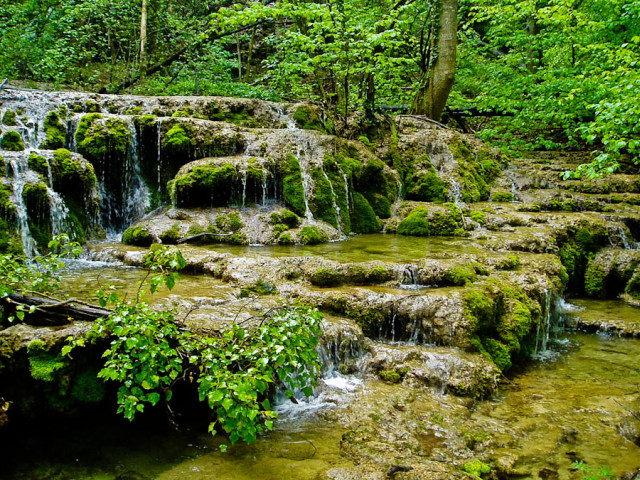
Yew Cascade is the first remarkable object in the canyon. It is a small picturesque waterfall flowing into a wide basin at the foot of huge stone boulders, braided with ivy and thick wet mosses. It is always gloomy here, and old yews spread their branches over the water.
From the yew cascade, you will first walk along a shady, dense thicket, a real jungle with ivy and ferns poking up between huge stones blackened with moss and lichens.
Then the road descends again to the stream where there are countless successive cascades, waterfalls, tubs, scenic rocks, etc. If you walk along the right (orographically) bank, you will definitely meet a narrow crawlway between large stone blocks on the way. Tourists joke that liars, talkers and unfaithful spouses are sure to get stuck between these rocks. Want to take a morality test?
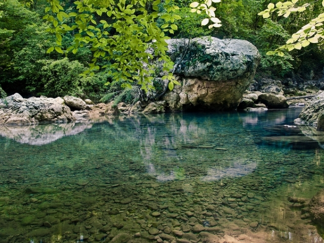
The next attraction is Blue Lake, a rather spacious expansion of the riverbed. In spring, the water in it is an amazingly beautiful emerald color (it is not clear only why it is called Blue?). But in summer, when there are many bathers in the lake, the water loses its original color and becomes muddy-green, and its shores resemble a city beach, and therefore do not beckon.
Further down, where the trail from the Post Oak descends to the canyon bed, is the Apple Tree ford, and a little further upstream is the Pania Spring. Its mouth is littered with rounded rocks covered with light green moss and is very picturesque.
Beyond Paniya, the waters of the Auzun-Uzen flow along a monolithic limestone bed. There is practically no sediment here. In the summer low season it is very interesting to walk not along the paths, but along the exposed bottom. 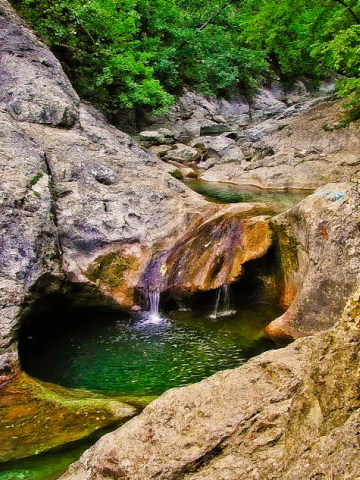
It abounds with numerous baths of various sizes. Geographers call them eworsion cauldrons, and Crimean Tatars call them lehenlers — troughs. They are formed as a result of rotational movement of stones inside the «bathtub» during a stormy flood. Once in the hollow, the stones play the role of a drill. They are rotated by the flowing water along the walls of the bathtub, further increasing its depth and giving it a rounded shape.
Eruption cauldrons are usually rounded, but often there are also hollows in the shape of a huge footprint, as if a snowman or a giant bear had walked here.
The final point of the route is the deepest bathtub — the «Bath of Youth». In old times it was called Kara-Gol (black lake), and «Bath of Youth» was dubbed by tourists in the 60s. The water in the bathtub is always cold. Even in the summer heat is not more than 9-10 degrees. That’s why, having plunged into its cold waters, even elderly people jump back with such speed, as if suddenly rejuvenated. The depth of the «Bath of Youth» is about 5 meters. It is filled with the waters of the spring, located 150 meters up the stream, on the right side of the canyon.
All excursion routes end at the «Bath of Youth». What will be your further way — it is up to you.